


Location: Ripon
1201 W. River Rd


Local Conditions

Check traffic on specific highway
(In the box under ‘Check Current Highway Conditions’, put in the highway number that you would like to check)
Check traffic flow in selected areas
(Use the Caltrans ‘QuickMap’ feature. Select one or more of the top three boxes listed. Then select one of the areas listed in the ‘zoom to’ area)
![]()
Mistlin Sports Park
Pictures/nearby food/location map![]()
Food Near Mistlin![]() ( Revised 7/10/22 )
( Revised 7/10/22 )
Twisted Tulip Frozen Yogurt
Hotels Near Mistlin Sports Park
Starbucks Near Ripon
Movie Theaters Near Mistlin Sports Park
Videos
Mistlin Sports Park South Side Video
Mistlin Sports Park North Side Video
Mistlin Sports Park, View From Field #8 Video
Mistlin Sports Park, View From Field #1 Video
Mistlin Sports Park, Main Complex, Video
Nearby Things To Do
Boomers
Boomers Website Here
Funworks
Funworks Website Here
Shopping Malls
Vintage Faire Mall
Vintage Faire Mall Location![]()
Vintage Faire Mall Property Map
Vintage Faire Mall Home Page
Promenade Shops, Manteca

Store Listings
Store Map
Web Site
Hours
Driving Directions:
Highway 99 N to highway 120 bypass (Tracy/San Francisco) Exit at Union Road, turn left
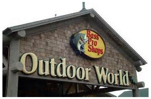
The mall includes the BASS PRO SHOPS store which is a tourist attraction, due to the interior of the store. It is an outdoor adventurers dream store.
This map will expand/move, click & hold on map to move it around. Click on lower left box to switch from street map to satellite view and back. Click on ‘View On Google Maps’ to get larger map.
Stadium Center, Manteca
Stadium Center Pictorial & Store Information Stadium Center Manteca
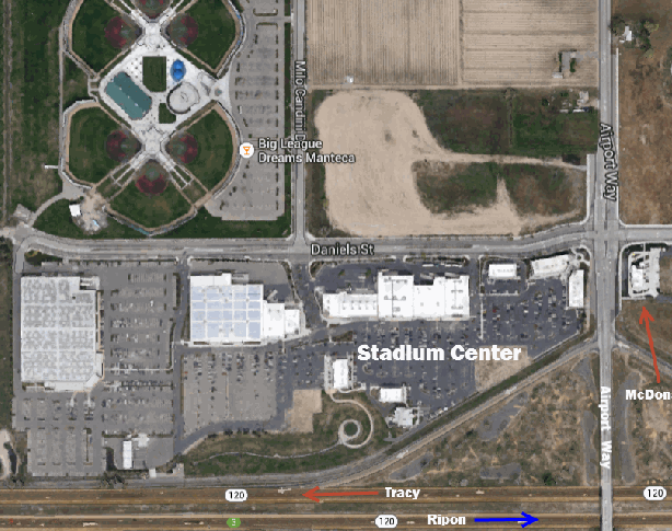
Driving Directions:
Highway 99 N to highway 120 bypass (Tracy/San Francisco)
Exit at Airport Way, turn right
This map will expand/move, click & hold on map to move it around. Click on lower left box to switch from street map to satellite view and back. Click on ‘More Options’ to get larger map.
San Francisco Premium Outlets – Livermore

For those traveling east bound, on highway I-580, going to games in the San Joaquin Valley/Sacramento areas, or if you are traveling west on I-580, heading for games in/near the Bay Area, you have a treat. In Livermore, the San Francisco Premium Outlet Mall is an upscale outlet mall, with a wide variety of well-known merchants. The mall is located on the south side of east bound 580, right next to the freeway.

Copyright © 2014, Jack Smith, All rights reserved. Information contained within this site may not be reproduced on another site, or copied into other documents, in part, or whole.